|
About
|
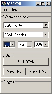
AIS2KMLInterrogates the UK Airspace Information Service (http://www.nats-uk.ead-it.com) for NOTAMs relevant to your area and generates a Google Earth KML file for ease of viewing. It also saves a highlighted HTML file and both are stored for viewing at a later date. You will need to register at the website first, NOTAMs are downloaded to c:\notams Example screenshot:
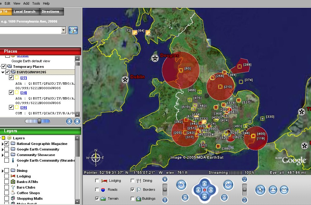
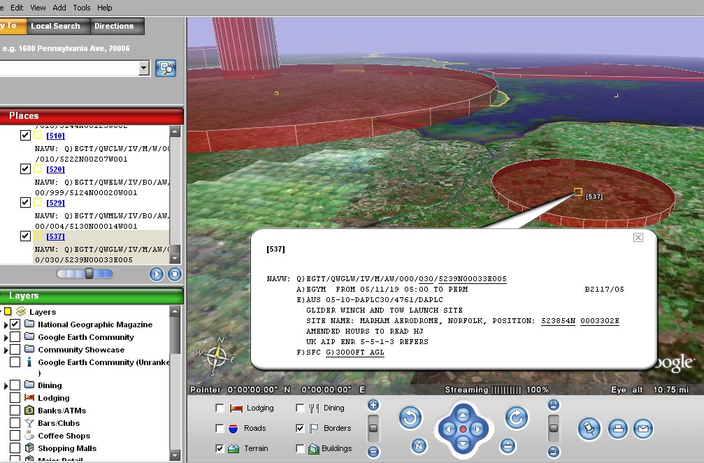
Example Google Earth output:
If you'd like to donate for AIS2KML click here: Download version 2.41 installer here To install, simply click on the link above and select run. Once it has downloaded, follow the instructions and it will automatically install and add a short-cut in your 'Start' menu. Once running, you must first go to the 'File' menu and then 'Configure'.
Here you need to set your username and password and then close the window (click top right box) before the program will work. As this is third party software and not maintained on a daily basis it should be used for guidance only. It should not be relied upon for flight planning, though I have yet to observe any issues with it. If you do find a problem, please report it so I can fix and share with everybody else. More recently other NOTAM viewing tools and websites have been made which handle some things better than AIS2KML. A particularly good site is http://www.notaminfo.com/ which shows areas better than this program (which assumes a route). Using both in parallel is a good check. |