|
ABOUT
|
What it isCoordinate Helper is a utility that allows you to convert coordinates, plan and declare routes. It will also import Google Earth kml placemarks (waypoints) for easy selection. You can copy the resulting information and view the route using Google Maps. It can also generate "dummy" igc file which can be useful for scoring in friendly competitions. Example use: 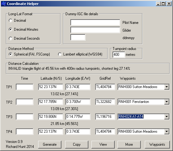
Example output on pressing "copy": 52 23.137N 0 3.743E (TL404784) [RNH000 Sutton Meadows] 52 17.785N 0 3.700W (TL322682) [RNH001 Fenstanton] 13.02 km [27.14%] 52 19.806N 0 14.775W (TL196716) [RNH024 A1-A14] 13.09 km [27.30%] 52 23.137N 0 3.743E (TL404784) [RNH000 Sutton Meadows] 21.85 km [45.56%] INVALID triangle flight of 45.56 km with 400m radius turnpoints, shortest leg 27.14% (using turnpoint radius of 400m and WGS84 Lambert elliptical method) Example output on pressing "view": 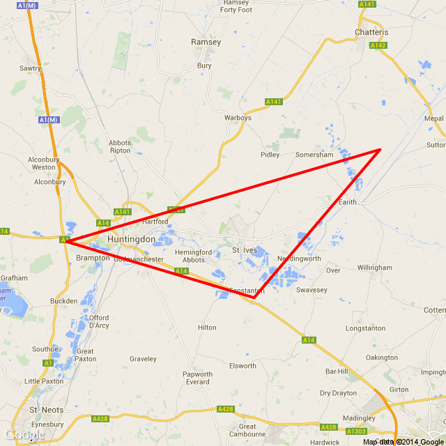
|